DIGITAL reality
Precise measurable insights with our innovative 3D scanning.

Experience a new era of Digital Reality with our Advanced Drone survey and Laser Scanning.
Unlock exceptional insights with advanced drone surveys, 3D laser scanning, and ground-penetrating radar. These innovative technologies provide precise data for construction, archaeology, and infrastructure projects. Streamline workflows with high-resolution imaging, 3D modeling, and subsurface analysis. Achieve accuracy and efficiency in your next project by leveraging these modern surveying solutions
Transform your projects with our aerial surveying capabilities, delivering accurate data and functional insights from the skies.
Unlock new possibilities with our 3D Laser Scanning services, utilizing high-end laser scanners to generate detailed 3D models. Explore infrastructure, assess conditions and make precise measurements effortlessly with our services.
Explore hidden features beneath the surface and within structures using our versatile Ground Penetrating Radar (GPR) services, offering valuable insights for a wide range of applications.


CASE STUDIES
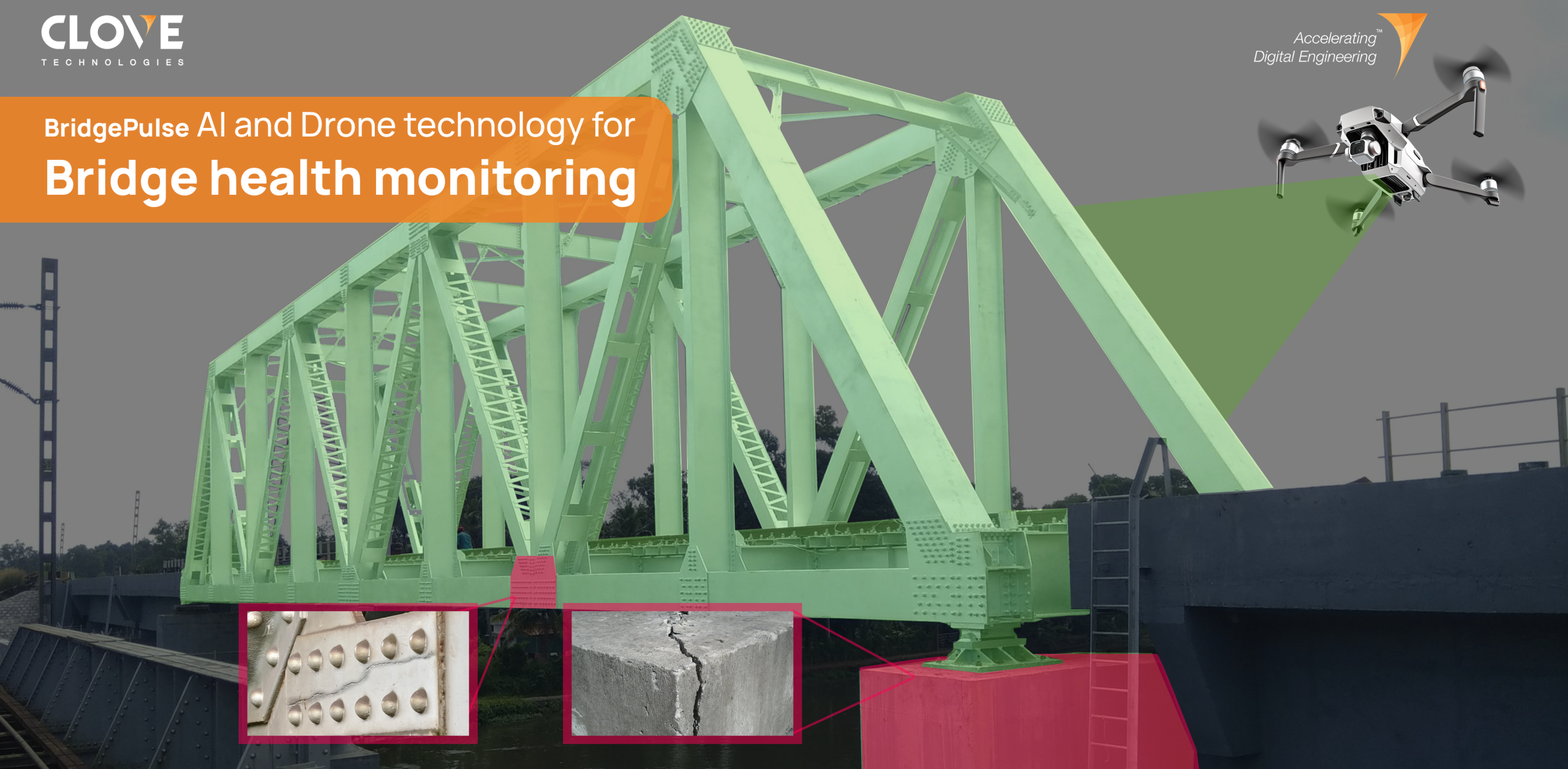
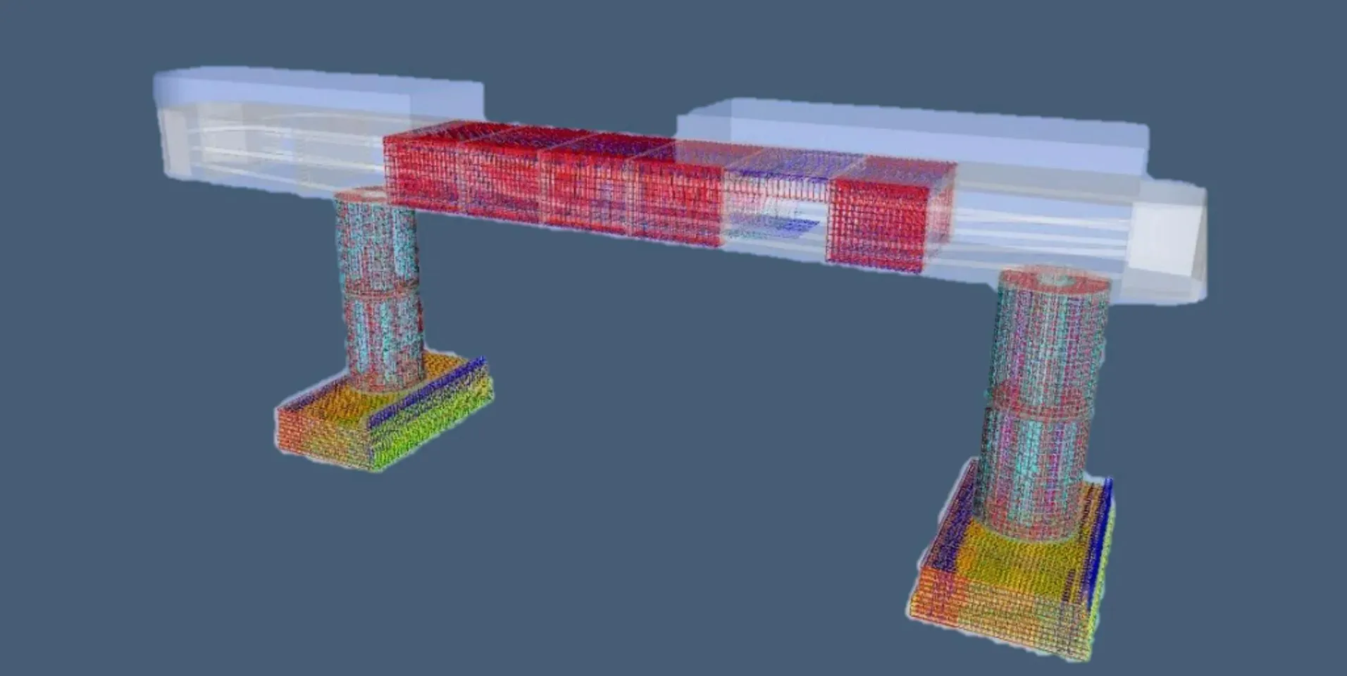
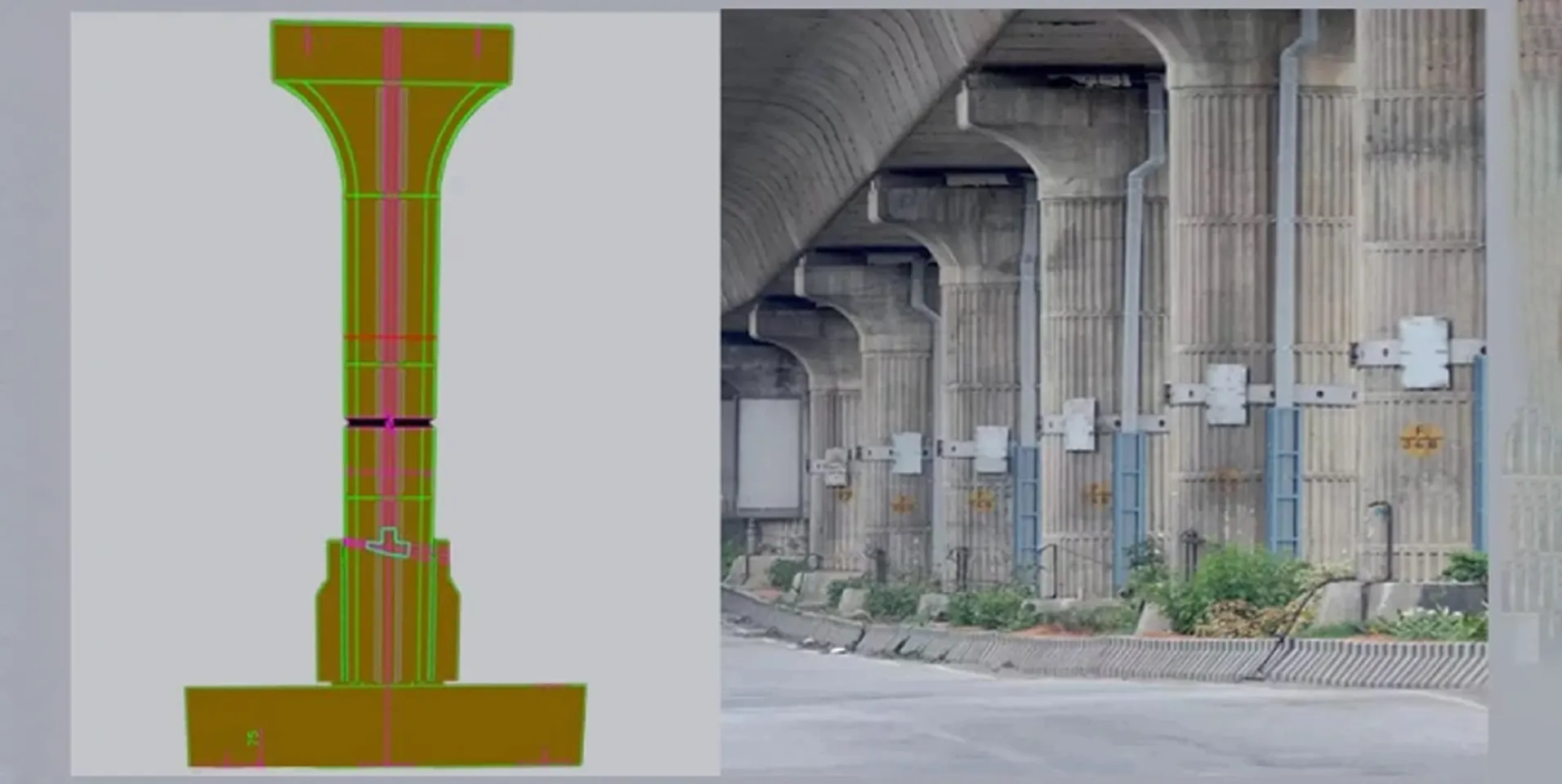
BridgePulse – AI and Drone technology for bridge health monitoring

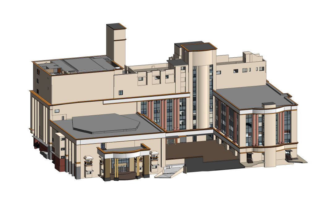
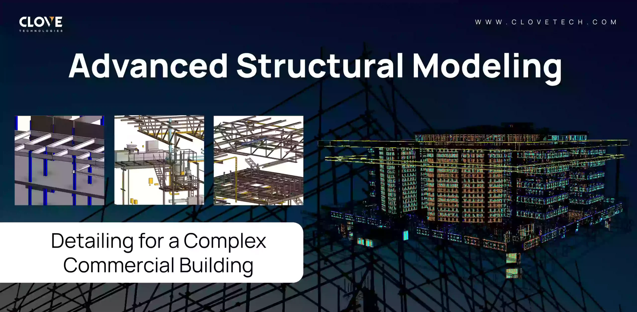
Scan to BIM
Commercial Building
Scan to Bim
Commercial Building
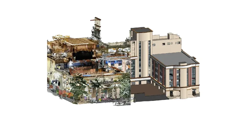
Scan to BIM
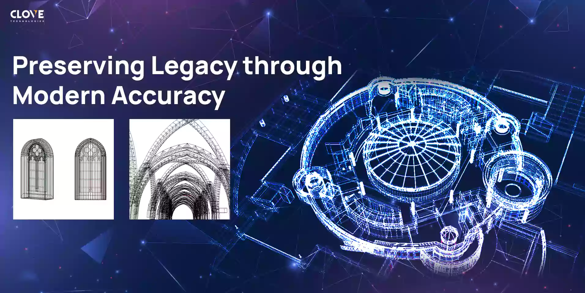
Historical Building
This case study highlights how our Scan to BIM services...
Digital Built
Natyakala mandir
This case study shows how our services accurately measure, visualize...
BIM Consultancy
Bar bending schedule (BBS)
PhotoGrammetry
Cutting-Edge Digitized GIS Custom Map Solutions
Clove Technologies isn't just mapping your world, they're creating a...
Architectural
Transforming Facades with BIM Expertise
Clove Technologies brings facades to life with BIM expertise! See...
APPLICATION DEVELOPMENT
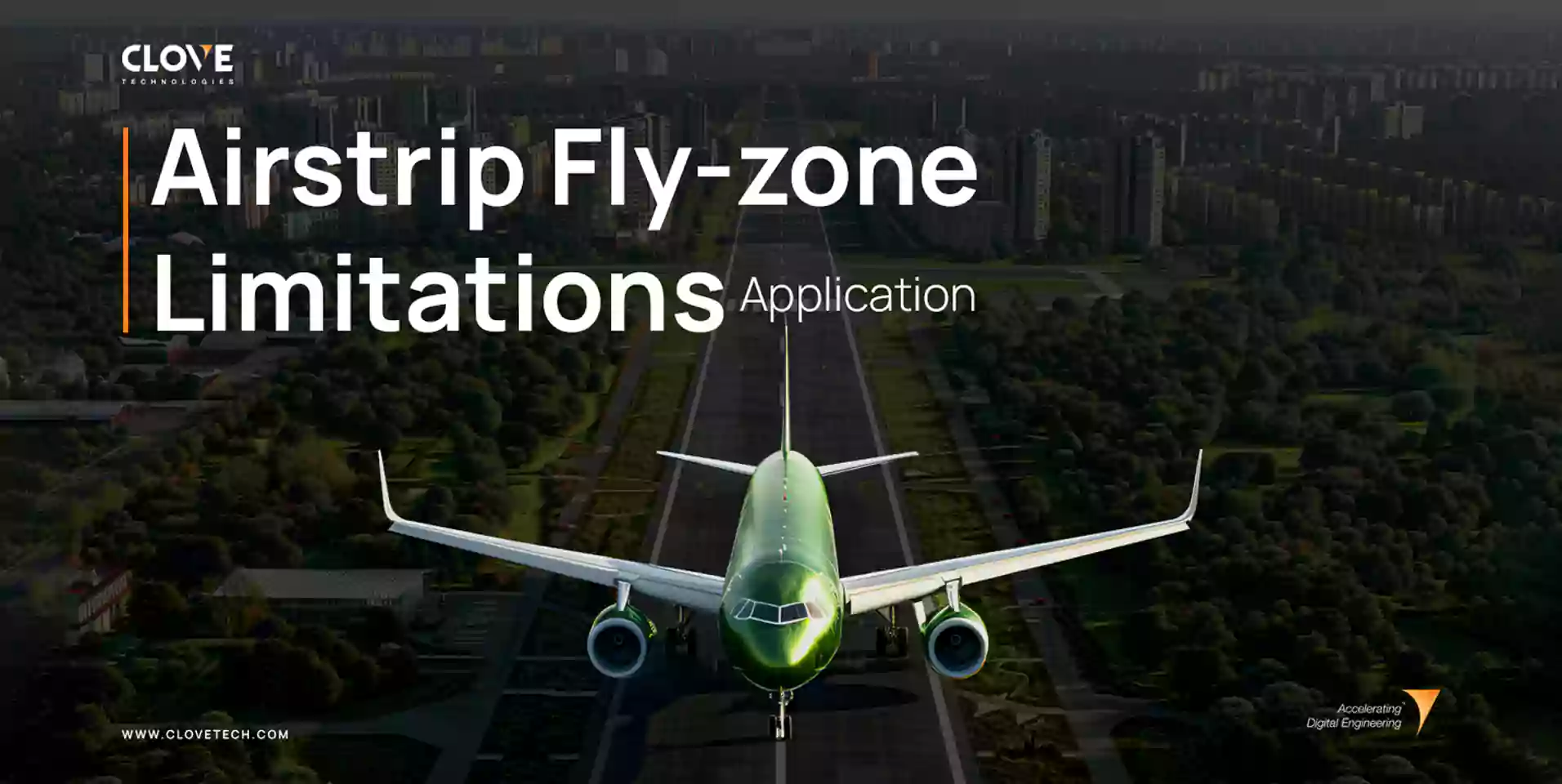
Airstrip flyzone limitations
BIm Consultancy
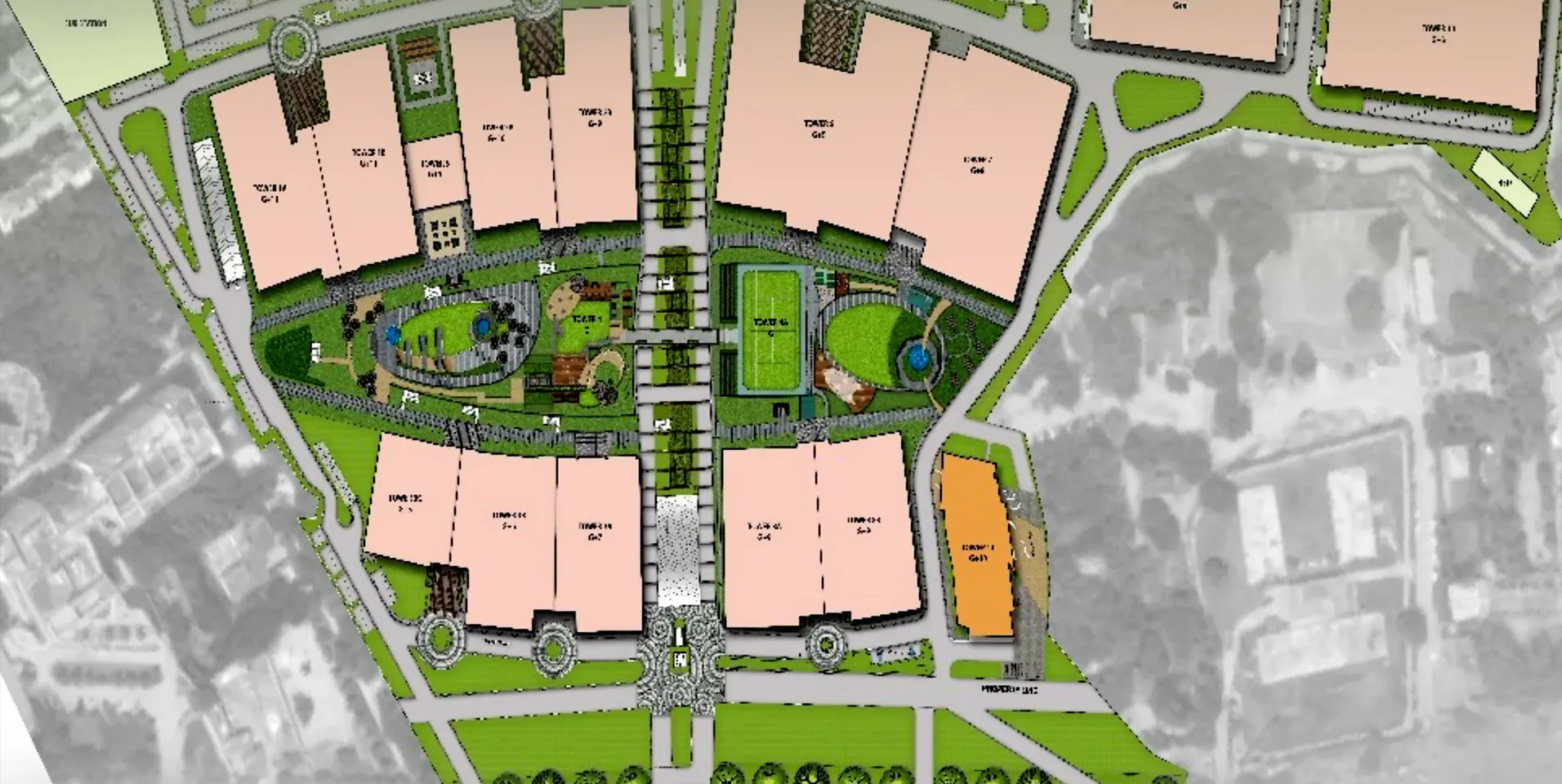
Nagpur metro
This case study shows how our services enabled the creation...
FAQ
In Digital Reality, we offer drone surveys to generate mesh models and point clouds, Ground Penetrating Radar (GPR) survey for subsurface feature identification and 3D laser scanning to create immersive virtual experiences.
The advantages of using Digital Reality include improved visualization and understanding of complex data, enhancing decision-making and problem-solving. It also boosts communication, training, and collaboration, promoting innovation and providing a competitive advantage for businesses and organizations.
Digital Reality services can be integrated into industries such as architecture, real estate, healthcare, education, manufacturing, entertainment, retail, defense and tourism.
Our Digital Reality services provide clients with a variety of outputs, including precise True Orthoimages, accurate Elevation Models, detailed Mesh Models, comprehensive Point Cloud data, panoramic 360 images, high-quality Videography footage, efficient surveillance solutions, precise inspections, detailed 2D drawings and 3D models, immersive virtual tours and seamless integration of virtual and augmented reality for enhanced visualization and digital measurements, ensuring comprehensive and efficient project management.
In Digital Reality services, key technologies like image capturing, LiDAR and radar are employed for data collection. Tools such as radar imaging devices, laser scanners and UAVs complement these technologies, working together to capture, process and analyze data for immersive digital experiences.
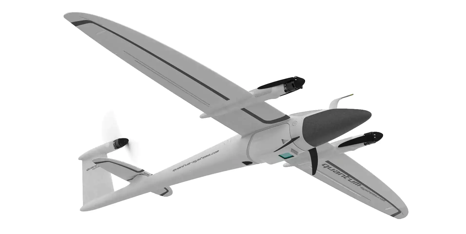
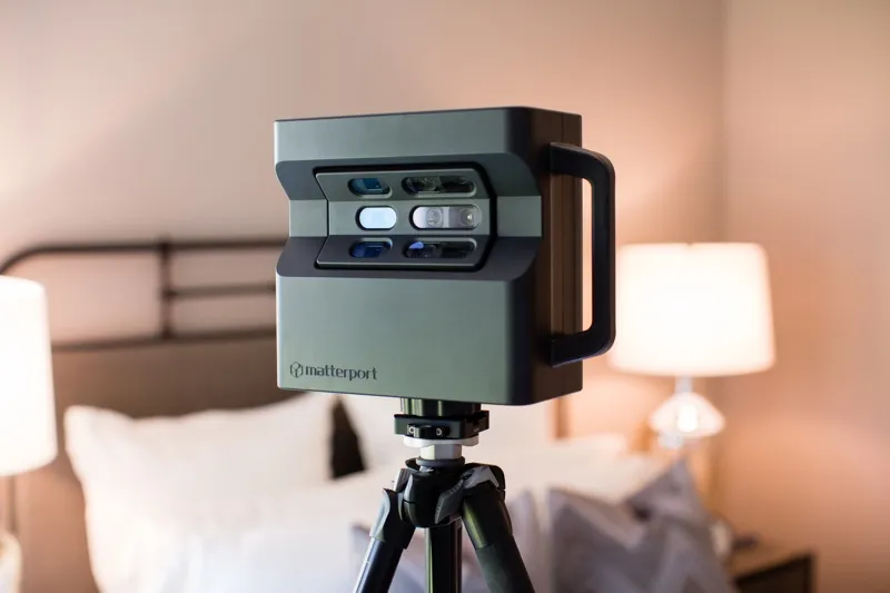
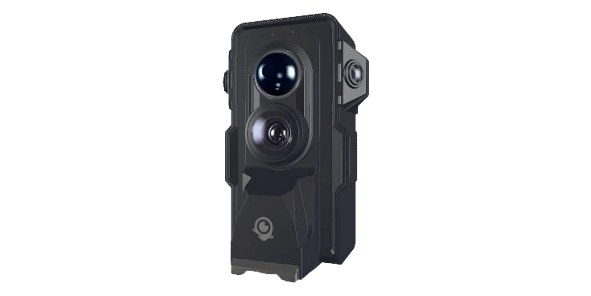
At Clove, we possess various devices such as NavVis M3 (Mobile Laser Scanner), NavVis VLX3 (Wearable Mobile Laser Scanner), Matterport (Terrestrial Laser Scanner), Matterport Pro2 (Terrestrial Laser Scanner), Sensefly eBee (Fixed-Wing Drone), Quantum Trinity F90+ (Fixed-wing VTOL drone), DJI Phantom Pro 4 V2 (Multi-rotor drone), Garmin VIRB (360 degree action camera), Contour 2+ ( Video camera), Stereolabs ZED2 (Stereo camera) which enable us to provide top-notch Digital Reality Services.
Let's Talk
Let’s discuss your requirements and see how our expertise can help on your next project.