
WHAT WE SEEK TO ACHIEVE ?
The Deshpande project aimed to accurately assess, visually represent and simulate the indoor areas of a mini auditorium in Mumbai, Maharashtra. This supported retrofitting with precision and inviting visuals.
PROJECT INFORMATION:
| Client: | Owners |
| Service: | Drone Survey, 3D Laser Scanning, Scan to CAD |
| Industry: | Commercial |
Software Used:
WHAT DID WE DO TO ACHIEVE THIS ?
Clove Technologies undertook the project and executed the following steps to fulfill the objectives.
Key Takeaways & Insights
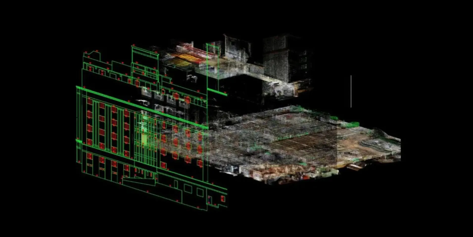
The project utilized both UAV (Unmanned Aerial Vehicle) data and NavVis, an advanced scanning device. This data was carefully analyzed and organized to segregate it into exterior and interior sections, setting the stage for creating accurate models.
Finalizing the Model
The use of NavVis technology enabled the acquisition of precise measurements and clear visuals of the auditorium's structural condition. Laser scans from NavVis were employed to create a detailed point cloud dataset. This dataset was further transformed into a 2D representation, aligning with the client's specifications.
Data Collection Convenience
NavVis offered various methods for data collection, including point cloud data gathering, panoramic image capture and map views. To accurately represent the eight-storied building's different levels, data was aligned to corresponding floors.
Modeling and Visualization
Following Deshpande's instructions, the modeling was conducted at a scale of 1:100. This scale effectively showcased the building's dimensions and facilitated the display of detailed floor plans, sections and elevations.
CHALLENGES
SUMMING UP OUR RESULTS
The successful execution of the project involved the utilization of UAV data and advanced scanning equipment, NavVis. The data was precisely aligned, processed and segmented to achieve accurate modeling of both external and interior components, aligning with the client's specific requirements. The utilization of rich point cloud data and diverse visualization choices from NavVis contributed significantly to providing Deshpande with an authentic and accurate portrayal of the eight-story building.
OUTCOME
Providing a wide-range visual representation of the Deshpande's interior, allowing for precise identification and assessment of areas that require attention.
