Airstrip Fly-zone Limitations Application

Developed an application to generate precise limitations for the input location for activities like new airstrip planning, drone operation, infrastructure development, or any task requiring compliance with airport vicinity regulations.

Objective

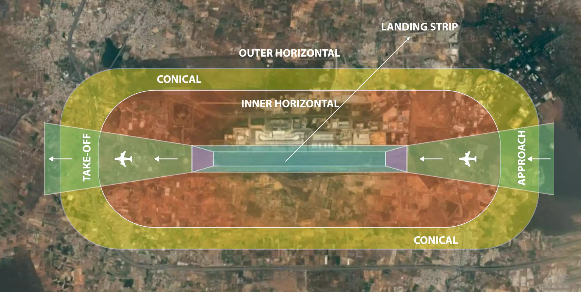
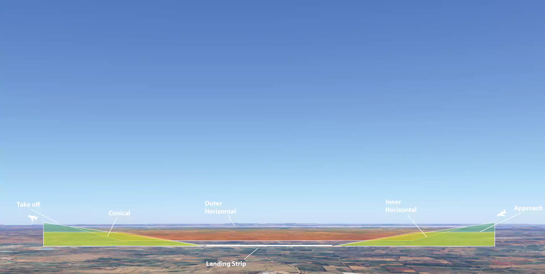
To develop an application to assess airstrip limitations for various distances, presenting the results in 3D. To enable users to visualize zones around airports with their specific restrictions, stretch and elevation details. To enable the application to generate precise limitations for the input location, making it invaluable for activities like drone operation, infrastructure development, or any task requiring compliance with airport vicinity regulations.

PROJECT INFORMATION:
Client: Surveyors
SERVICE: Application Development
INDUSTRY: Airport

Background

Airport surroundings are subject to strict regulations due to air traffic safety concerns. Accurate, real-time data on airstrip limitations is crucial for planning safe drone flights and infrastructure projects.
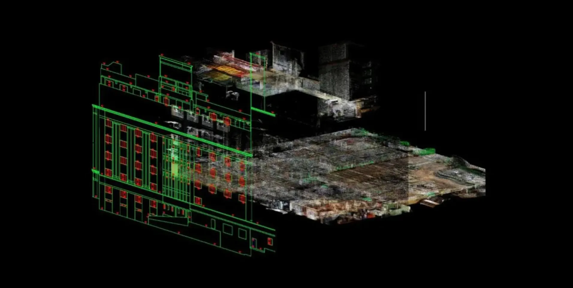
Implementation

Data Input: The user is responsible for digitizing airstrips, whether they are already existing or newly proposed. In this step, the layout of the airstrip is precisely mapped, and precise details regarding its size, orientation, and location are recorded.
Analysis: The application performs a comprehensive analysis to determine potential restrictions based on various critical factors. These include the surrounding areas, nearby key locations such as residential zones or industrial facilities, designated restricted zones, and the distances from sensitive infrastructure. Additionally, the system evaluates elevation data and other parameters, such as terrain features and regulatory compliance requirements. This ensures that all potential obstacles and limitations are thoroughly assessed.
3D Visualization: The results of the analysis are presented in an interactive 3D visualization. Different zones around the airstrip are color-coded or otherwise differentiated to illustrate varying levels of restrictions.

Use Cases

Here are some use cases for the application that we have developed:

Drone Operations: The application helps drone operators identify safe flight zones around airports, ensuring compliance with airspace restrictions and avoiding potential hazards.
Infrastructure Development: Developers can assess airstrip limitations and zoning restrictions when planning construction projects near airports, ensuring buildings meet height and distance regulations.
Airport Safety and Management: Airport authorities can use the tool to monitor and manage obstacles within the airspace, enhancing safety for aircraft operations.
Urban Planning: Urban planners can integrate airport restrictions into city planning processes to avoid conflicts with airspace regulations.
Regulatory Compliance: Companies and individuals can ensure their activities around airports adhere to local and international regulations, reducing the risk of legal issues.
Airstrip Planning: Point cloud data facilitates the planning of airstrips by assessing site feasibility, identifying restrictions, and evaluating sensitive areas around proposed locations. This application ensures compliance with safety standards and environmental regulations, helping design optimal layouts while minimizing risks and obstructions.

This application streamlines safety assessments and regulatory compliance, making it a valuable tool for various industries operating near airports.

Outcome

The project's outcome is a precise, data-driven solution that makes it easier to establish new airstrips while assessing the limitations around ones that already exist. By integrating detailed analyses with interactive 3D visualizations, the application ensures that all possible constraints, such as elevation, distance, and surrounding areas, are clearly identified and addressed. This enhances decision-making, promotes regulatory compliance, and optimizes airstrip placement and management.

Conclusion

This application serves as a vital tool for stakeholders operating near airports, providing critical insights into airspace limitations and ensuring that all activities comply with aviation safety standards.

Download
Download

If you intend to act, we are ready to help!