
PROJECT SCOPE
Clove Technologies recently concluded a project summarizing smart usage of navigational applications that will provide for better visual perspective and space management of an entire campus facility.
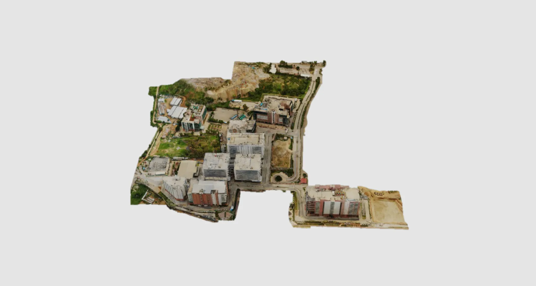
The whole area to be captured and processed was approximately 15 Acres.
PROJECT INFORMATION:
| Client: | Owners |
| SERVICE: | Photogrammetry |
| INDUSTRY: | Commercial |
Software Used:
WE DELIVERED
SOLUTIONS
Clove offered innovative Spatially enabled Web Based ‘Data Centric’ solutions that reflects Reality ‘As Is’ using technologies such as:
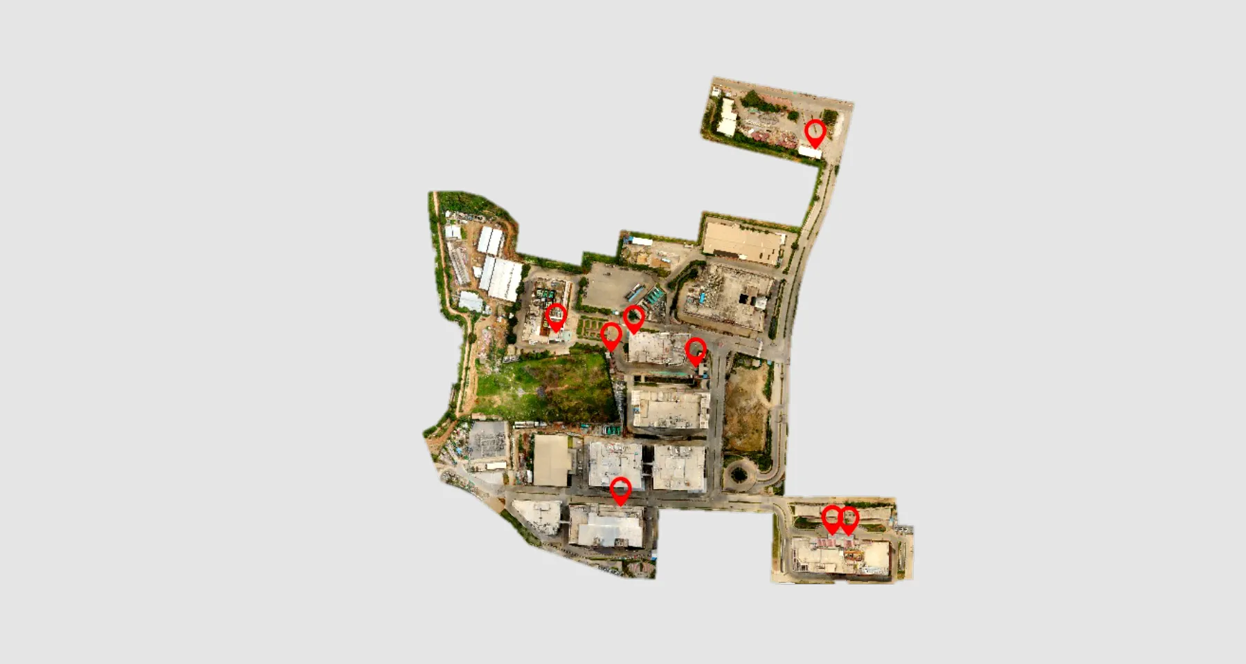
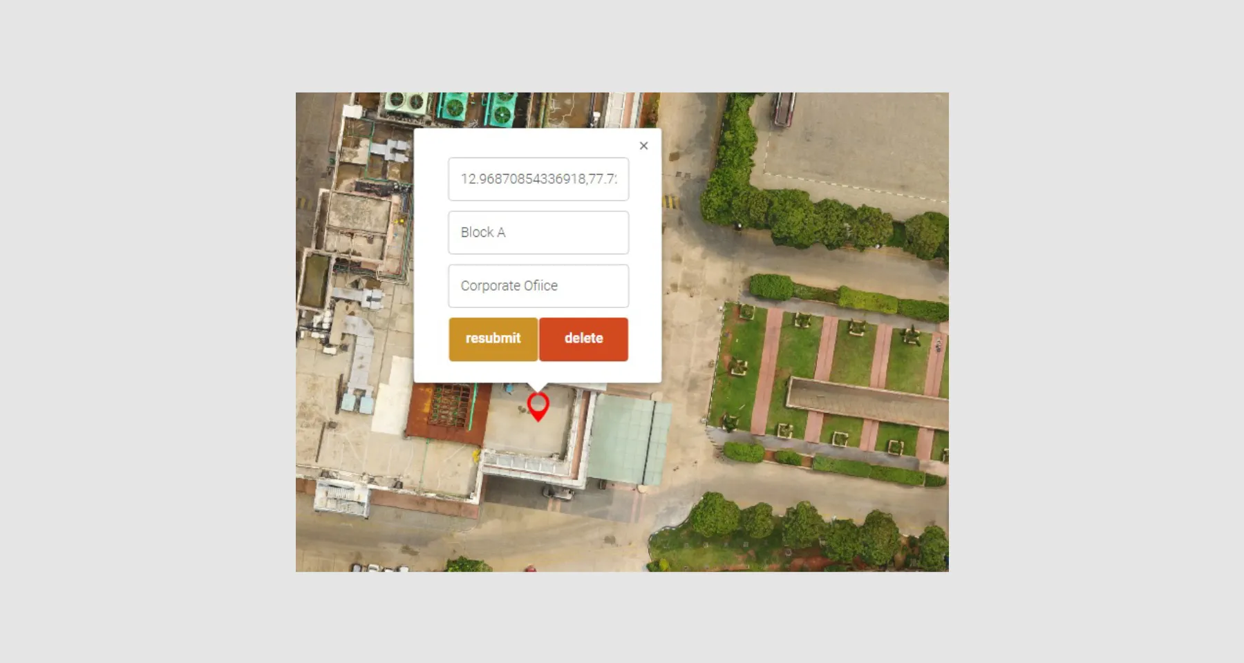
POINT OF INTEREST REGISTRATION
Adding location intelligence to the basic street maps and shapefiles by extracting or adding Points of Interest (PoIs). Our Cartographic experts skillfully add geo-referenced Points and Features of Interest using various layered datasets and indicators to improve functional value of the maps. Our team creates dedicated geographic entities to each point, that supports several navigational and information applications such as digital mapping, augmented routing apparatus and private database validations.
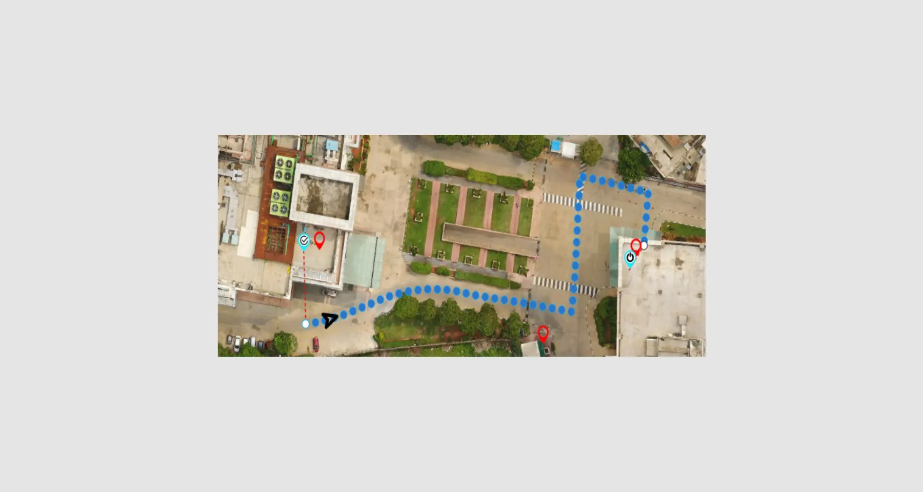
OUTDOOR NAVIGATION
Client was able to select a start and end destination points for navigational route for his desired experience.
We generated be spoke datasets to achieve street-level fully routable vector path network with turn-by-turn navigation specifications
INDOOR NAVIGATION
NAVVIS indoor scanner was used to perform the indoor scanning activity and created fully interactive digital twins of indoor spaces.
The Client was able access efficient routing through complex spaces and have visual tours of the inside facility.

TECHNOLOGY
Data Surveying Technologies that were used in the project included:

