
What did we seek to achieve ?
Accurate measurement, visualization and modeling of the interior spaces of Ravindra Natya Mandir.
PROJECT INFORMATION:
| Client: | Owners |
| Service: | Drone Survey, 3D Laser Scanning, Scan to CAD, Scan to BIM |
| Industry: | Commercial |
Software Used:
How did we achieve it ?
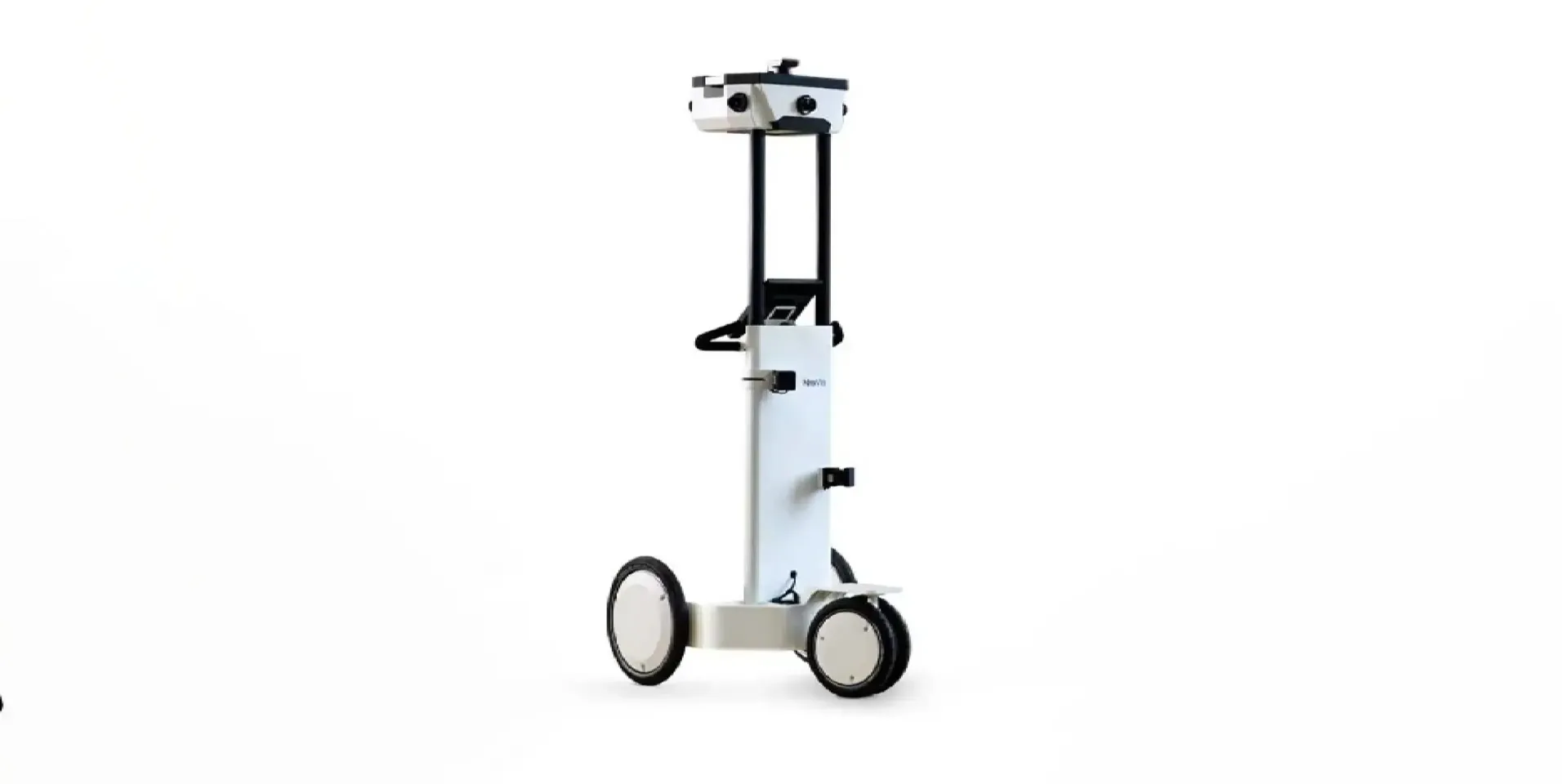
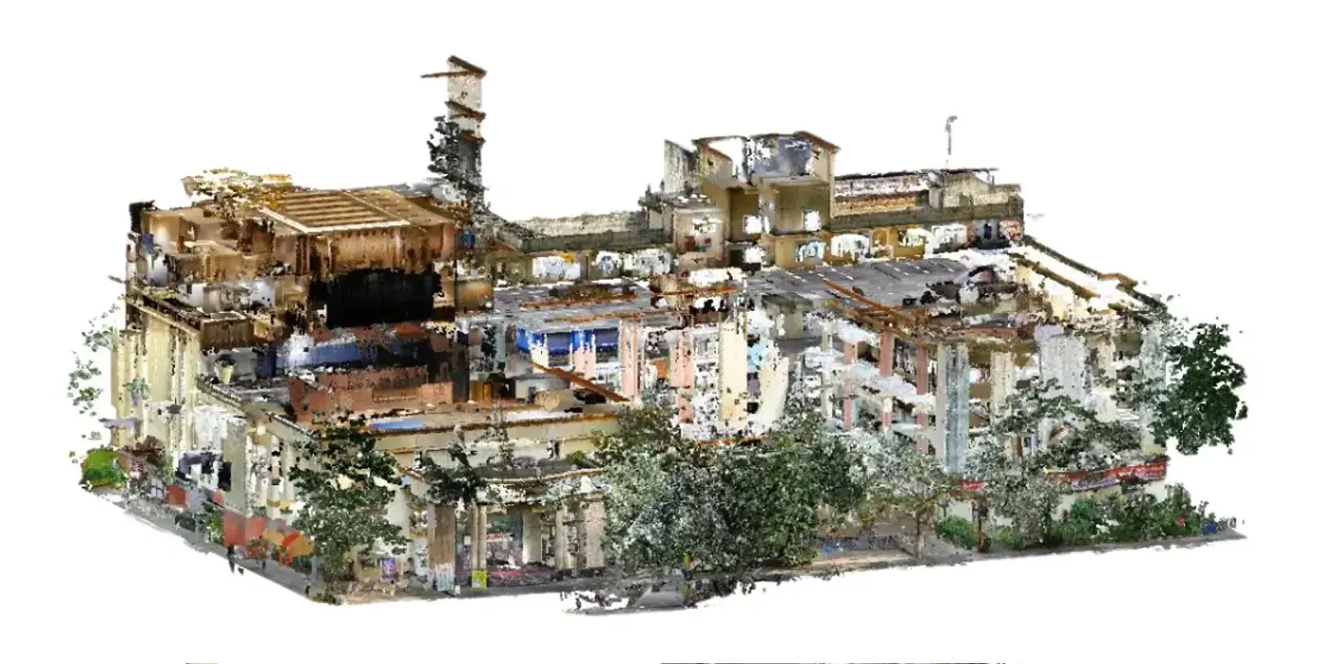
To meet the client's requirements, we employed NavVis, an advanced scanning equipment and UAV data, we aligned and processed raw data, segmenting into external and internal areas for precise modeling.Data provided by NavVis has precise measurements and clear visualization of structural damages. Laser scans were performed using NavVis, generating detailed point cloud data. The data was then transformed into 2D or 3D representations based on the client's specifications.
NavVis facilitated data collection in various views, including point cloud data, panoramic images and map views. We aligned the data floor-wise to accurately represent each level of the eight-storied building.
The collected data was handed over to our modeling team, who utilized both NavVis and UAV data. Alignment and processing of the raw data addressed if any registration issues were present. Alignment considered external and core areas, elevation, staircase areas and fixed elements.
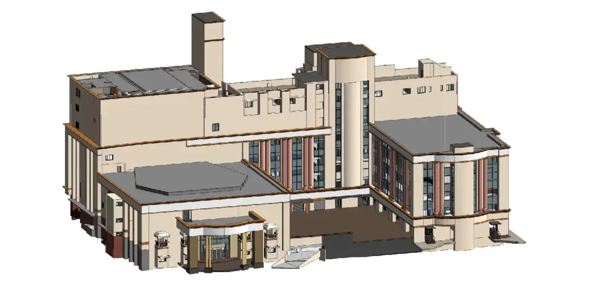
Modeling was performed at a Level of Detail (LOD) of 300, ensuring high accuracy. The models included textures and furniture, such as auditorium chairs, for a realistic portrayal of the spaces.
CHALLENGES
conclusion
Through the precise utilization of NavVis scanning equipment and data alignment processes, we successfully achieved our objective of accurately measuring, visualizing and modeling the interior spaces. of Ravindra Natya Mandir. Our complete representation enables precise identification and assessment of compromised areas, setting the stage for effective retrofitting measures.
OUTCOME
Provided a complete visual representation of Ravindra Natya Mandir's interior, facilitating precise identification and assessment of compromised areas.
