
PROJECT INCEPTION - 2000
In 2000, we initiated an ambitious and visionary project named CLV0987 - to model a commercial office space using advanced scanning technology. Our mission was to create highly detailed 3D models and illustrations, which we appropriately named "pre-demolition models." These models would serve as detailed documentation of the site before any demolition activities took place.
PROJECT INFORMATION:
| Client: | Contractors |
| Service: | 3D Laser Scanning, Scan to BIM |
| Industry: | Commercial |
Software Used:
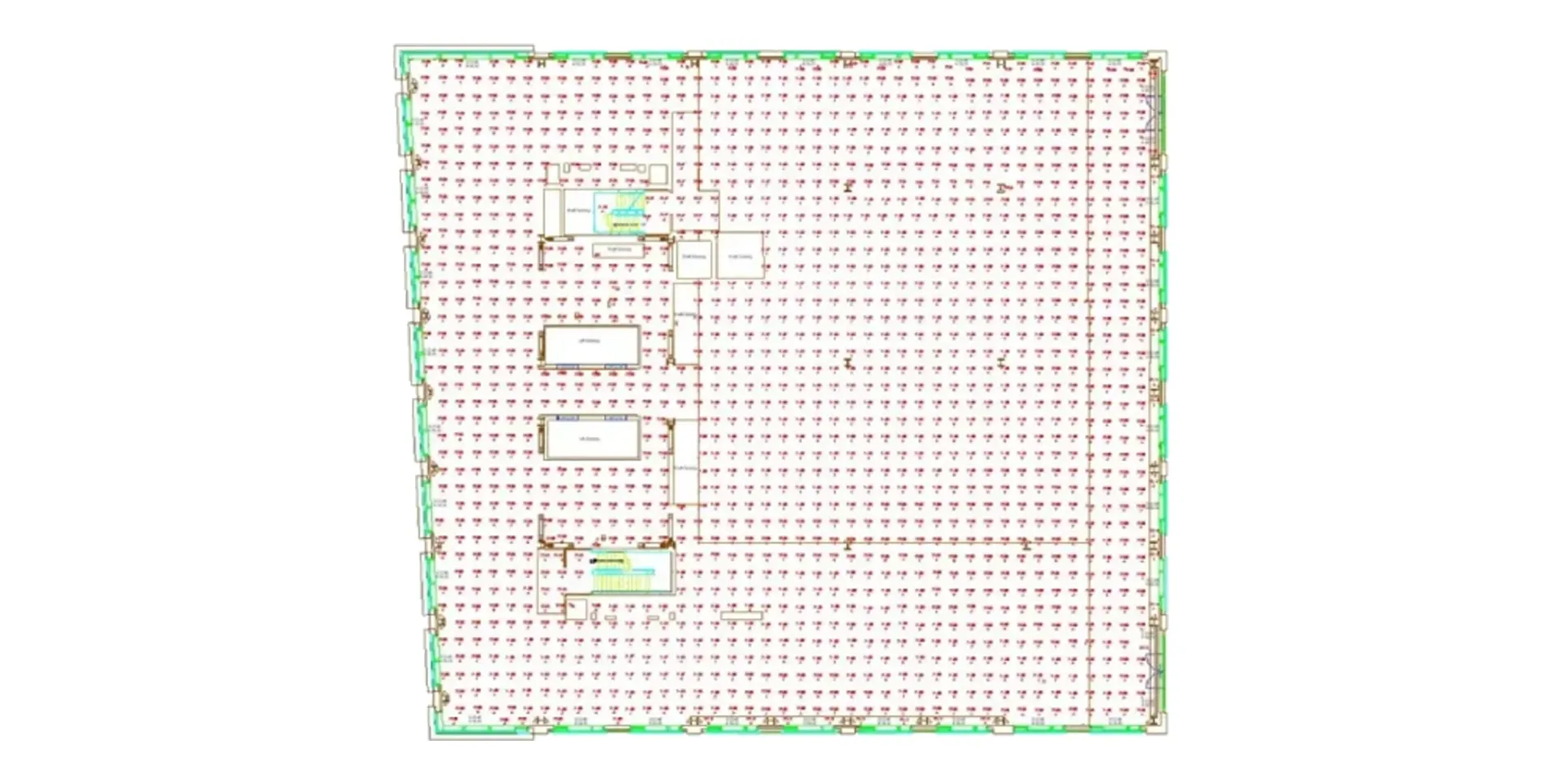
CAPTURING EVERY DETAIL - LOD 400 WITH 15 MM ACCURACY
Utilizing advanced 3D scanning techniques, we accurately captured every aspect of the office area in LOD 400, achieving an exceptional accuracy of 15 mm. The data collected was then transformed into high-quality 3D models, preserving every existing structure and object on the site. These complete models provided us with a complete picture of the office space's state before the demolition, further complemented with precise drawings.
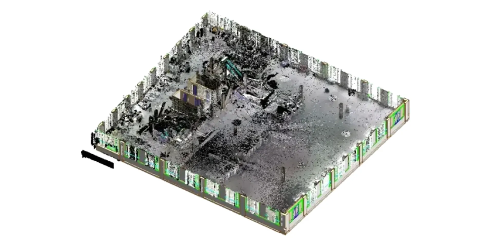
BEFORE AND AFTER - A TRANSPARENT CONTRAST
In 2010 under the same project, CLV0987 we returned to the site after the demolition had taken place. By implementing accurate 3D scanning once again, we created what we called "post-demolition 3D models." The sharp contrast between the previous state and the post-demolition span became transparently obvious through these models.
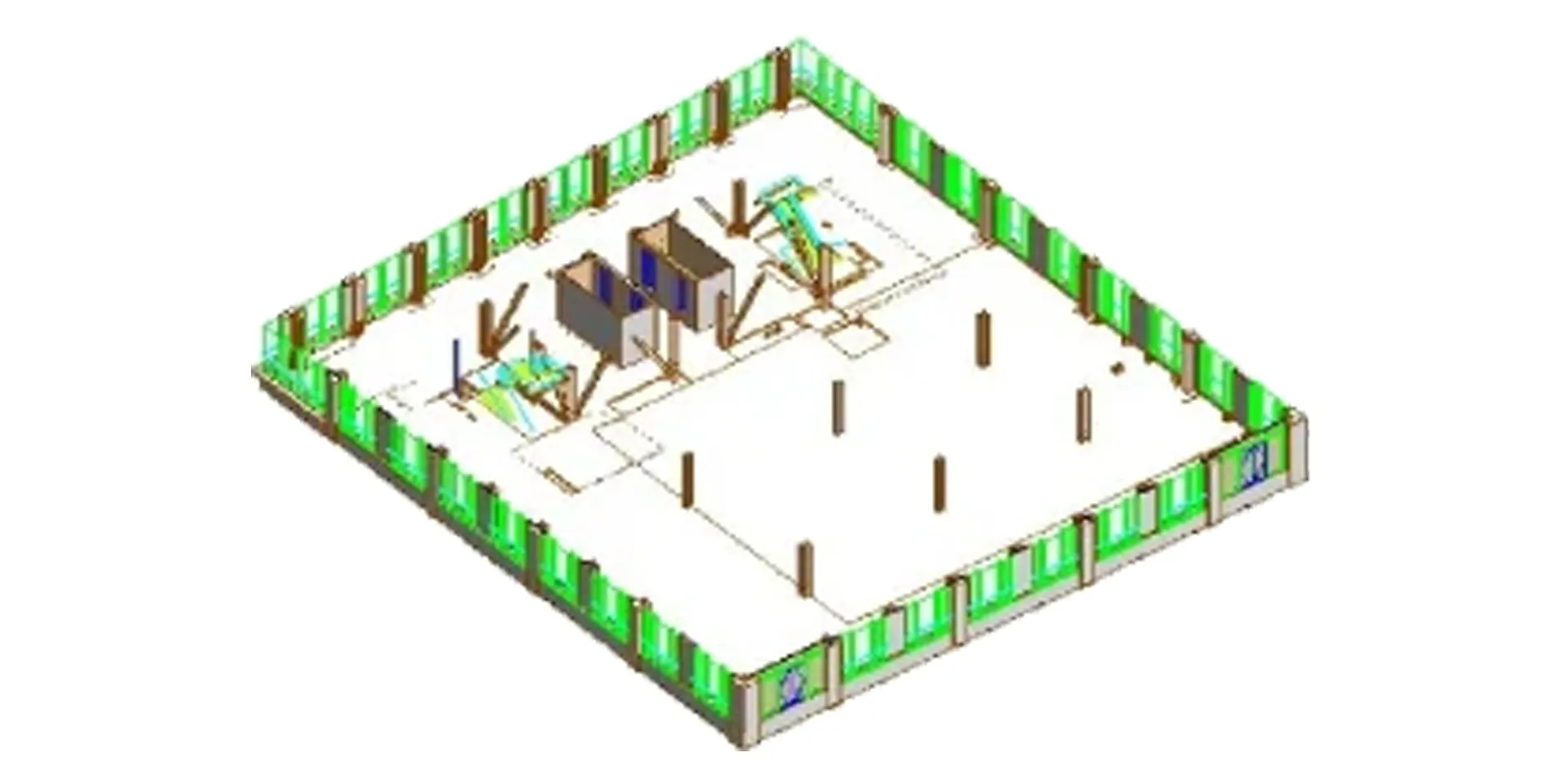
ENABLING STAKEHOLDERS WITH DETAILED 3D DOCUMENTATION
The post-demolition modeling technique provided invaluable 3D documentation, enabling stakeholders to make well-informed decisions and develop detailed plans for the future with insights into the past.
CONCLUSION - A GLANCE OF EVOLUTION OVER TIME
In conclusion, the effectiveness of post-demolition modeling in documenting a site's evolution over time cannot be overstated. The 3D documents provided our stakeholders with the power to make insightful decisions and shape the future development of the site with precision and confidence. This groundbreaking approach has set a new standard in the scope of site documentation, resolving to maintain innovation and excellence in every initiative we undertake.
OUTCOME
Started in 2000, CLV0987's 3D scanning effort produced accurate "pre-demolition" and "post-demolition" models with a 15mm resolution. These models gave clear insights into the site's development, assisting stakeholders in making knowledgeable choices and establishing new requirements for site documentation.
