
Boost your spatial understanding with our ability to transform images into accurate 3D representations
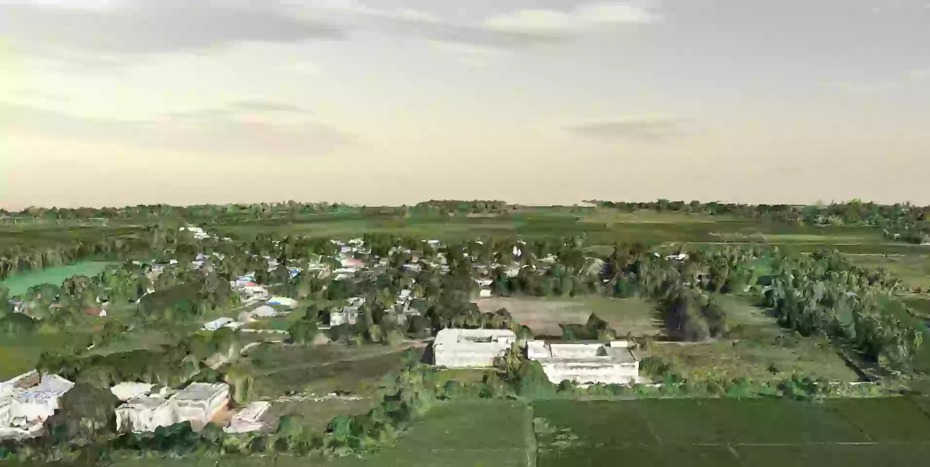
Our photogrammetry services deliver a comprehensive solution for capturing, analyzing, and interpreting detailed spatial data using aerial or ground-based imagery. By leveraging advanced techniques in aerial photogrammetry, we transform photographic images into accurate 3D models, mesh models, and detailed maps. These outputs enable precise measurements and clear visualizations of terrain, structures, and environments. Our expertise spans point cloud classification, mesh model generation, and aligning point clouds, as well as correcting image distortions and removing noise to ensure the highest level of accuracy. Whether for urban planning, environmental monitoring, or infrastructure development, our photogrammetry services provide invaluable insights for informed decision-making and strategic planning.
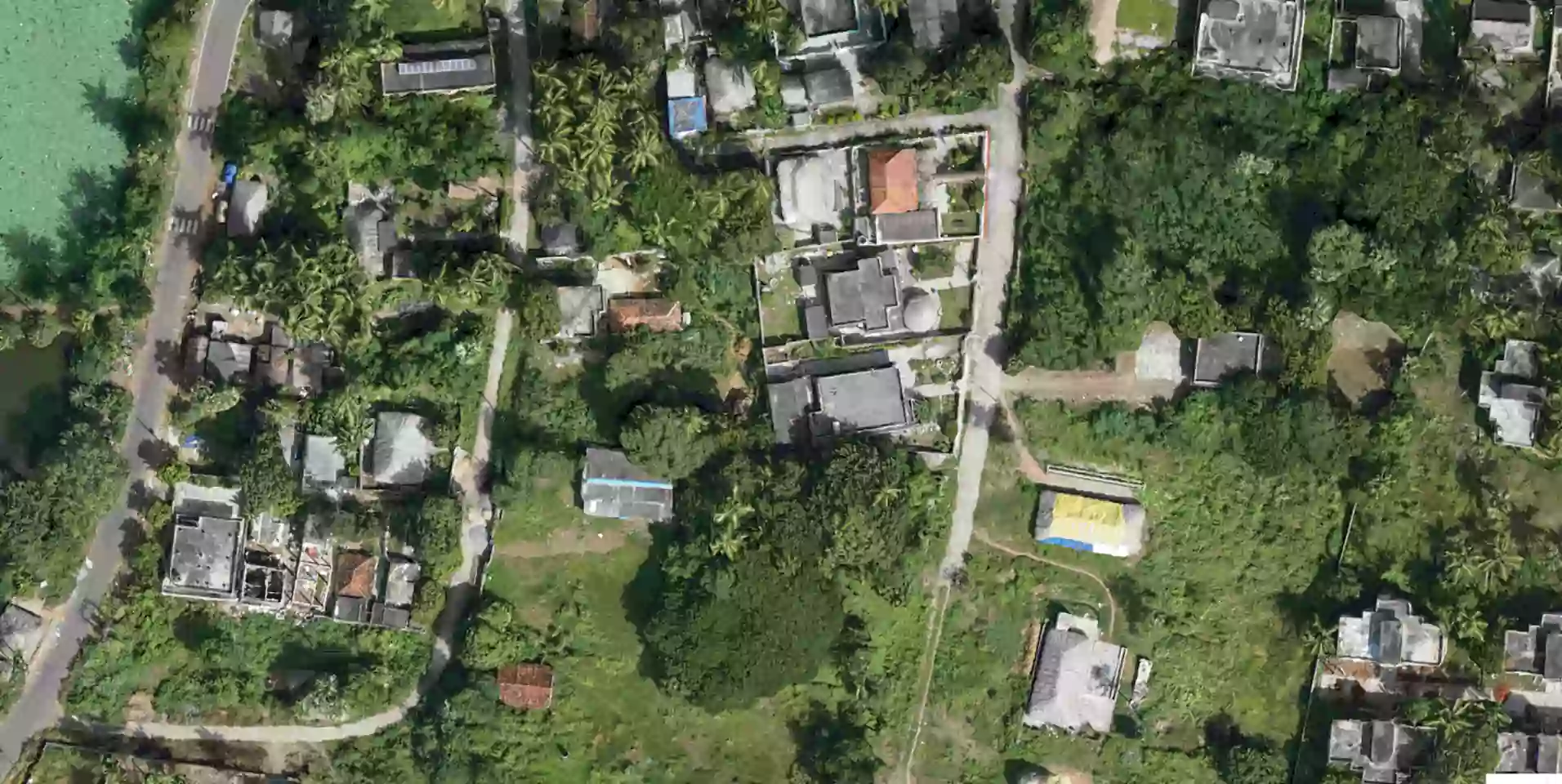
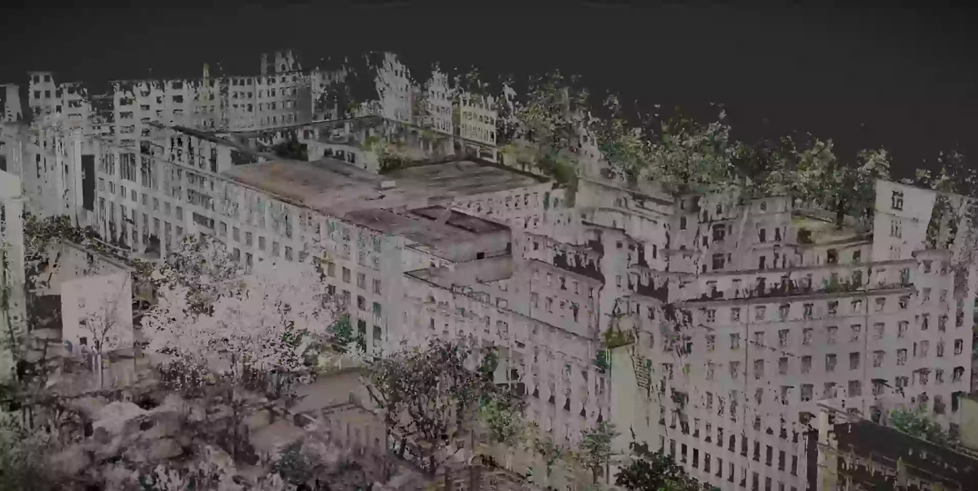
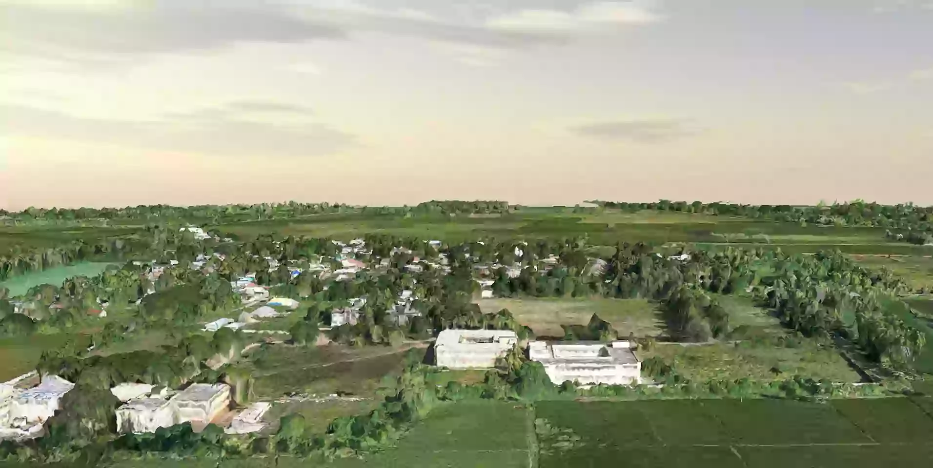
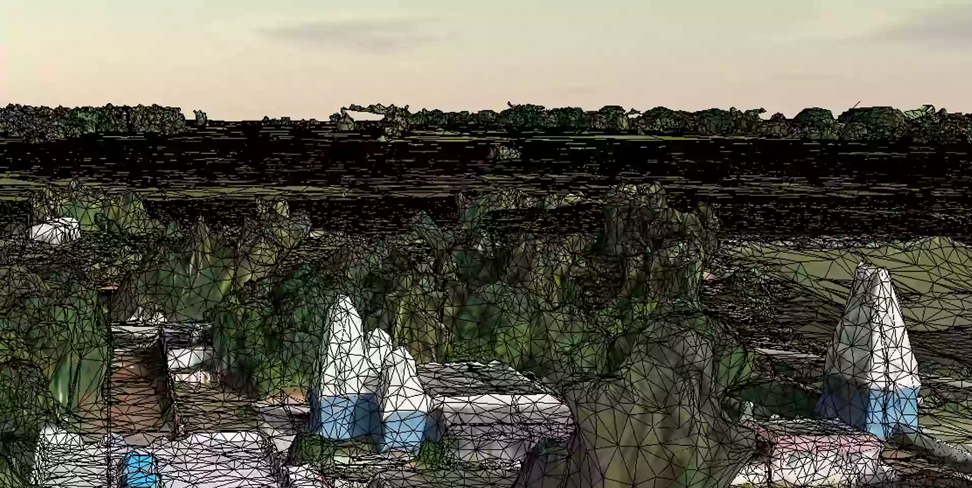
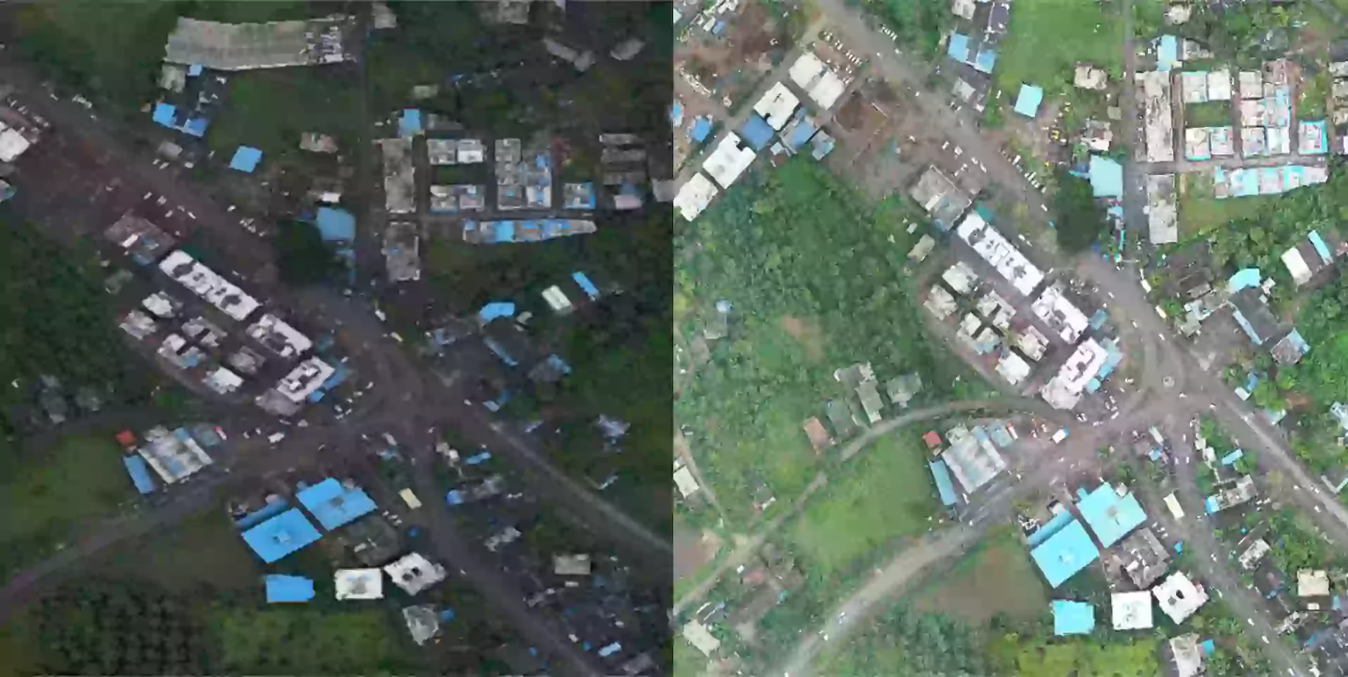
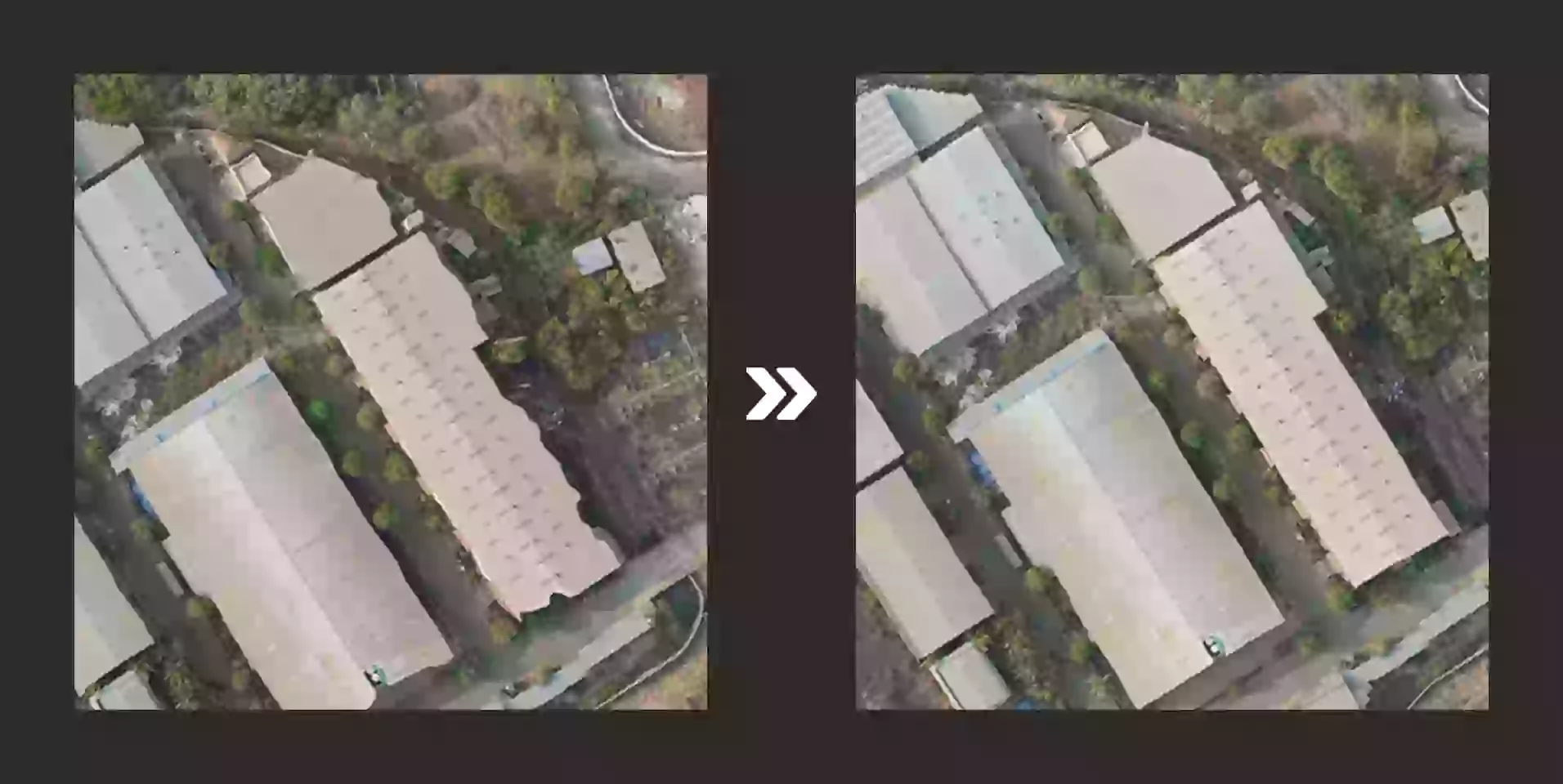
Image color balancing
Achieve consistent color balance across imagery for accurate visual interpretation.
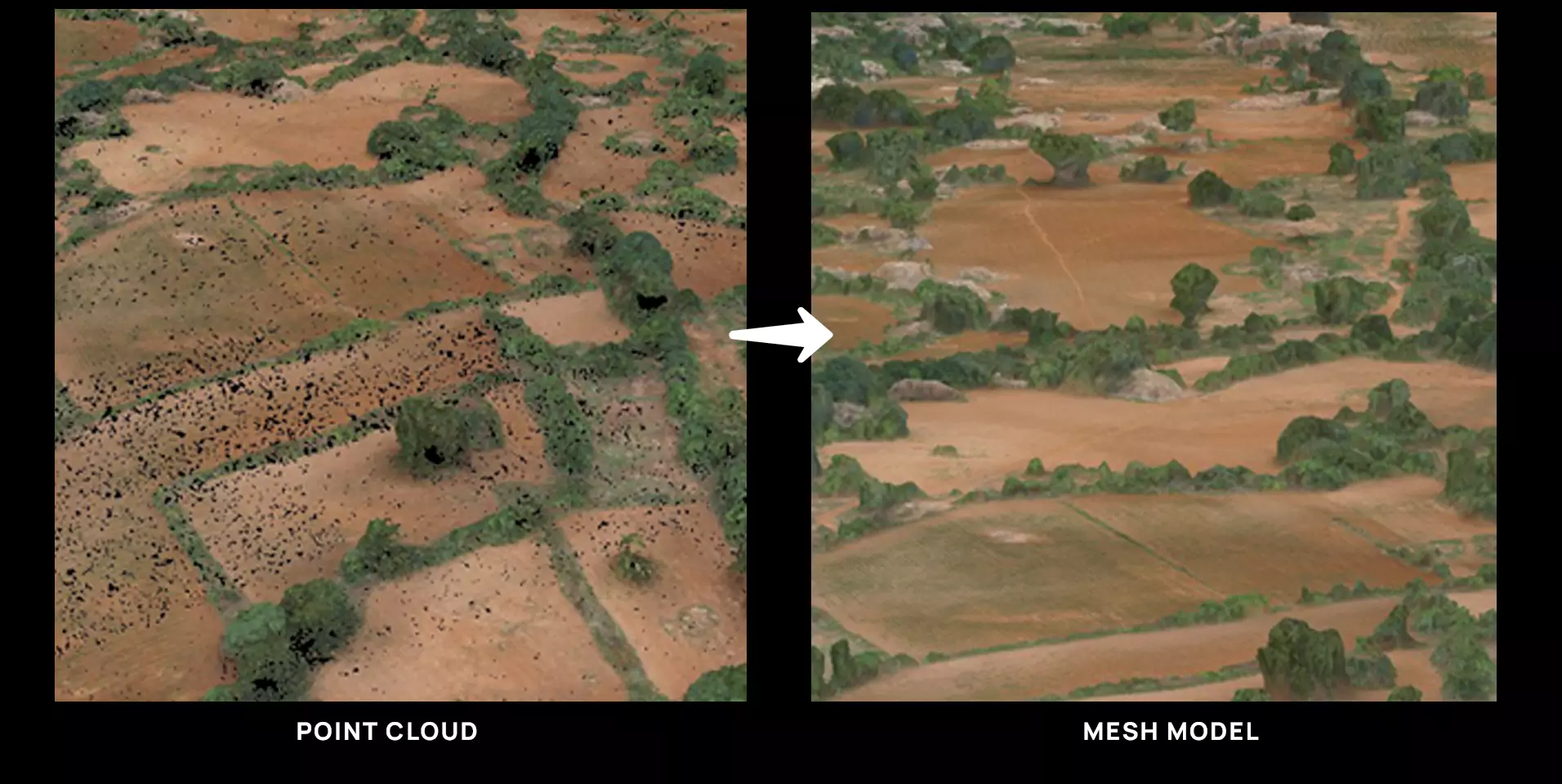
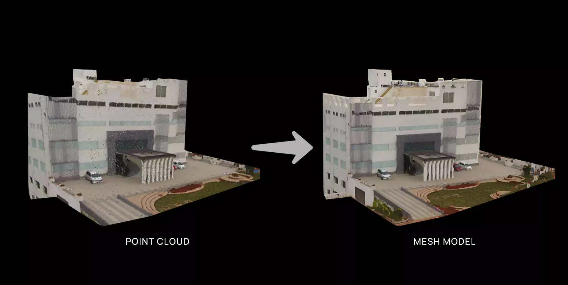
learn morePoint cloud to mesh model conversion
Convert point clouds into detailed mesh models for precise spatial representation.
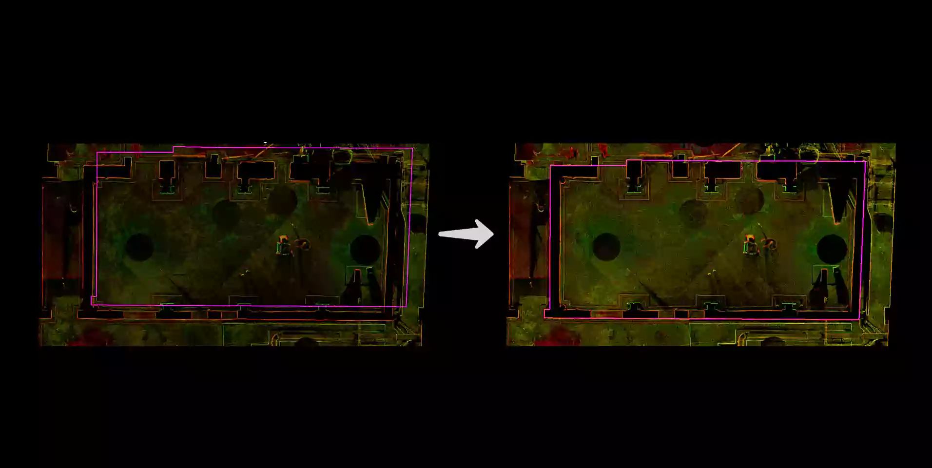
learn moreImage distortions correction
Achieve consistent color balance across imagery for accurate visual interpretation.
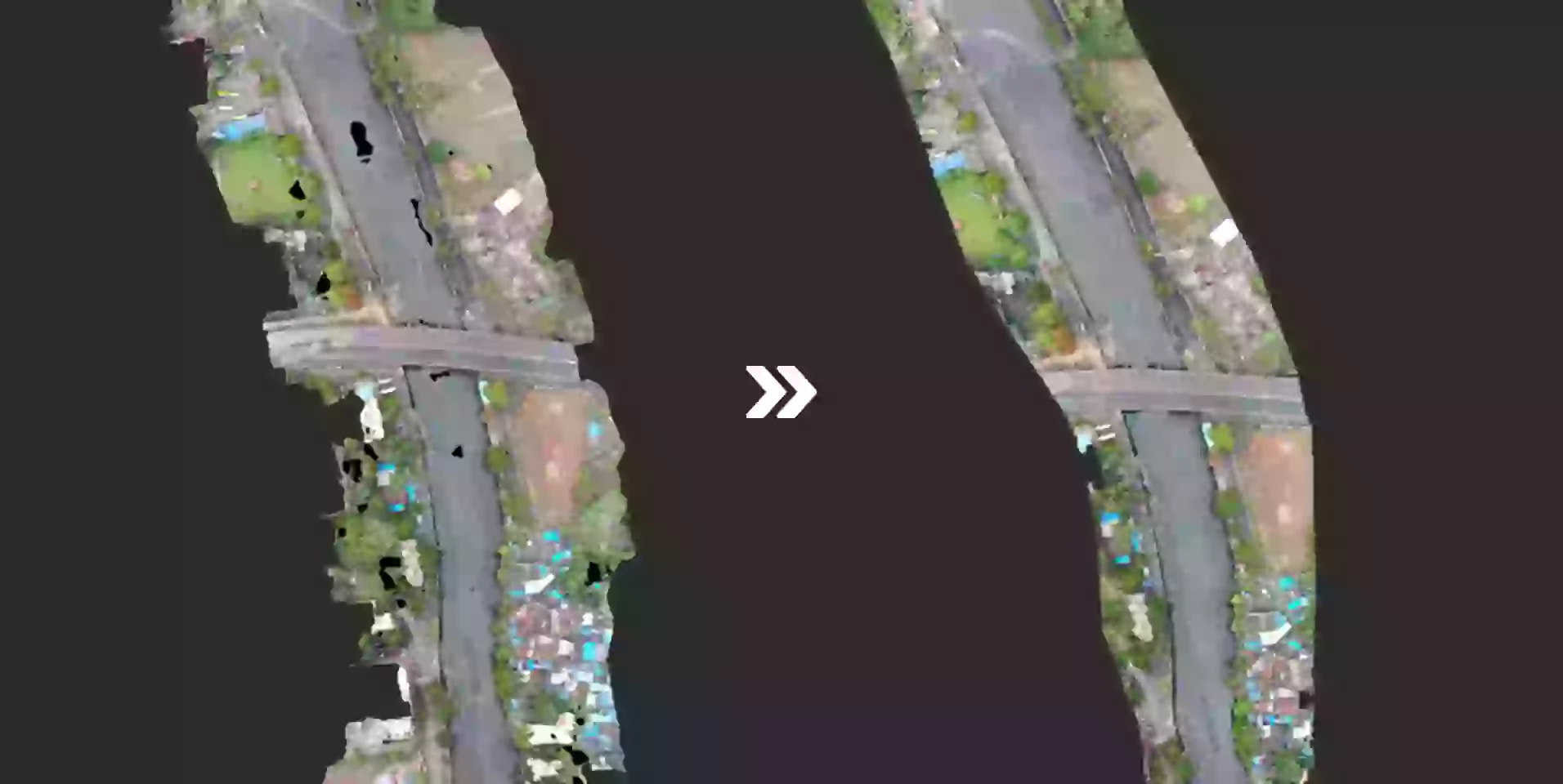
learn morePoint cloud alignment
Align point clouds for seamless integration and accurate spatial mapping.
learn moreOUR OFFERINGS
FAQ
Photogrammetry is a technique that captures reliable information about physical objects and the environment by recording, measuring and interpreting photographic images and electromagnetic patterns. By analyzing overlapping images taken from different angles, photogrammetry reconstructs precise 3D models of terrain, structures and objects.
Photogrammetry finds applications in various fields such as urban planning, environmental monitoring, infrastructure development, archaeology and forestry. It is used for creating accurate maps, measuring land features, monitoring changes in landscapes and planning construction projects.
Photogrammetry can utilize various types of imagery, including aerial photographs, satellite images, drone imagery, and ground-based photographs. The choice of imagery depends on the scale of the area to be mapped and the level of detail required.
Photogrammetry requires cameras capable of capturing high-resolution images, often mounted on drones, aircraft or ground-based platforms. Additionally, specialized software for image processing and 3D reconstruction is used to generate accurate models.
Yes, photogrammetry can be used for indoor mapping and modeling by capturing overlapping images of interior spaces. This technique is commonly employed in architecture, archaeology and construction to create detailed 3D models of buildings, structures and artifacts.
Photogrammetry may face challenges in areas with limited visibility or complex terrain, as well as in environments with moving objects or changing lighting conditions. Additionally, the accuracy of photogrammetric models can be affected by factors such as image distortion, camera calibration errors and the presence of obstructions.
Let's Talk
Let’s discuss your requirements and see how our expertise can help on your next project.