
Deploy advanced drones equipped with high-precision sensors to revolutionize aerial imagery capture, empowering various sectors.
Clove Technologies offers professional drone surveying services that provide accurate and efficient aerial mapping, 3D modeling, and geospatial analysis for various industries. Our advanced aerial surveying technology enables businesses in construction, mining, agriculture, and more to gather high-quality data quickly and cost-effectively. With our expertise in drone-based mapping, we deliver precise insights to improve decision-making, enhance productivity, and optimize operations.


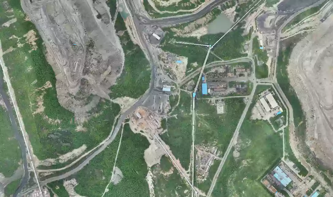
True orthoimage
Obtain precise True orthoimages capturing every detail of landscapes and structures.
learn moreMesh models
Create detailed Mesh Models for immersive visualization of landscapes and structures.
learn moreSurveillance
Conduct surveillance and security monitoring efficiently with our UAV-equipped surveillance solutions.
learn moreInspections
Perform inspections of infrastructure, buildings, and landscapes with precision using our Drone survey capabilities.
learn moreElevation models
Generate accurate Elevation Models to understand terrain variations and elevation changes.
learn morePoint cloud
Obtain a precise 3D point cloud for accurate visualization of structures and precise digital measurements.
learn moreVideography
Produce high-quality Videography footage for site inspections and project documentation using our UAVs.
learn moreOUR OFFERINGS


FAQ
A Drone survey involves capturing images or data of a particular area from an elevated perspective using drones or UAVs.
Drone surveys are beneficial for a wide range of projects, including land development, construction projects, environmental monitoring, agricultural assessments, infrastructure inspections and many more. They provide valuable insights and data that aid in planning, decision-making and analysis.
Using drone survey offers several advantages, including cost-effectiveness, flexibility in surveying various terrains, rapid data collection and the ability to capture detailed imagery from multiple angles.
Yes, "UAV" (Unmanned Aerial Vehicle) and "Drone" are often used interchangeably to refer to aircraft that are operated without a pilot onboard. Both terms typically describe the same type of aircraft, which is remotely controlled or autonomously operated for various purposes, including aerial photography, surveying, mapping and surveillance.
A Mesh model is a digital representation of an object using a collection of vertices, edges and faces. These elements form a network (mesh) that defines the shape of the object.
Elevation models are digital representations of terrain surfaces that depict variations in elevation across a geographical area. They provide information about the height or altitude of the land surface above a reference point, allowing for the visualization and analysis of terrain features such as hills, valleys and slopes.
An Orthoimage is a georeferenced aerial photograph or satellite image that has been corrected for distortion caused by terrain relief and camera characteristics, providing an accurate representation of the Earth's surface.
Let's Talk
Let’s discuss your requirements and see how our expertise can help on your next project.