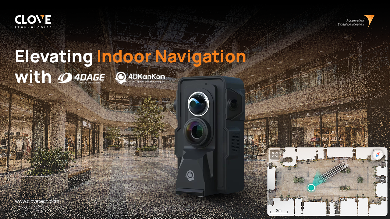
Clove Technologies captured navigation-ready indoor spaces using 4DKanKan META, combining LiDAR, SLAM and 16K panoramic imaging in a single indoor reality capture workflow. This case study shows how our team turned complex interiors into accurate spatial data for indoor mapping, BIM and indoor navigation development.
Visitors in a large mall look for a store, students on a campus look for a lecture hall, and residents or delivery staff look for the right block, lift or parking level. In each case, outdoor GPS stops being useful at the entrance: satellite signals weaken through roofs and slabs and carry no sense of floor level.
Indoor navigation fills that gap with three components: a digital indoor map, an indoor positioning method and routing software. The map comes first. Without accurate, current geometry of corridors, entrances, stairs and lifts, positioning and routing have nothing reliable to work on. This is where reality capture does its job.
Indoor mapping, indoor positioning and indoor navigation
- Indoor mapping creates the digital representation of interior spaces, organised by floor.
- Indoor positioning estimates where a device is inside the building, using Wi-Fi, Bluetooth beacons, ultra-wideband or visual methods.
- Indoor navigation combines both with routing software to guide people from point A to point B.
A laser scanner delivers the mapping foundation. A full navigation service also needs positioning infrastructure, a routable path network, an app or kiosk and integration with building systems. Clove focuses on the first stage and prepares data that navigation developers can build on.
4DKanKan META, developed by 4DAGE, is a stationary and mobile 3D laser scanner: one device for terrestrial-style station scans and SLAM walking capture. According to its official technical specifications, it offers:
- 905 nm Class 1 LiDAR at 200,000 points per second, with a 0.2 m to 70 m range
- Point cloud accuracy of 1σ ≤ 1 cm at 20 m
- Station scans in about 37 s (low density) or 80 s (high density)
- SLAM capture at walking pace, up to 1,500 m per scan
- 16K (16384 × 8192) panoramic imaging
- Projects of up to 99 floors, with dataset merging
- Point cloud download, .obj model export and virtual tours
For the buildings we capture, the value is the mix: dense station scans where detail matters, fast SLAM passes through long corridors, and panoramas that let clients verify every space visually.
Where indoor navigation mapping makes the biggest difference
Shopping malls, university campuses and residential developments share the same challenge: large, multi-level spaces that people must find their way through, and layouts that change faster than drawings are updated. In malls, that means atriums, escalator banks, retail corridors and parking levels, with storefronts and signage captured in 16K panoramas for accurate points of interest. On campuses, separate buildings are scanned one by one and merged into a single coordinated record, with optional RTK and geo-registration linking each building to campus digital mapping. In residential complexes and halls, SLAM moves quickly through repetitive corridors and stair cores while station scans document lobbies, basements and plant rooms in detail. The result in every case is measured spatial data that supports store and room finders, accessible routes, evacuation planning, facility management and Scan-to-BIM models.
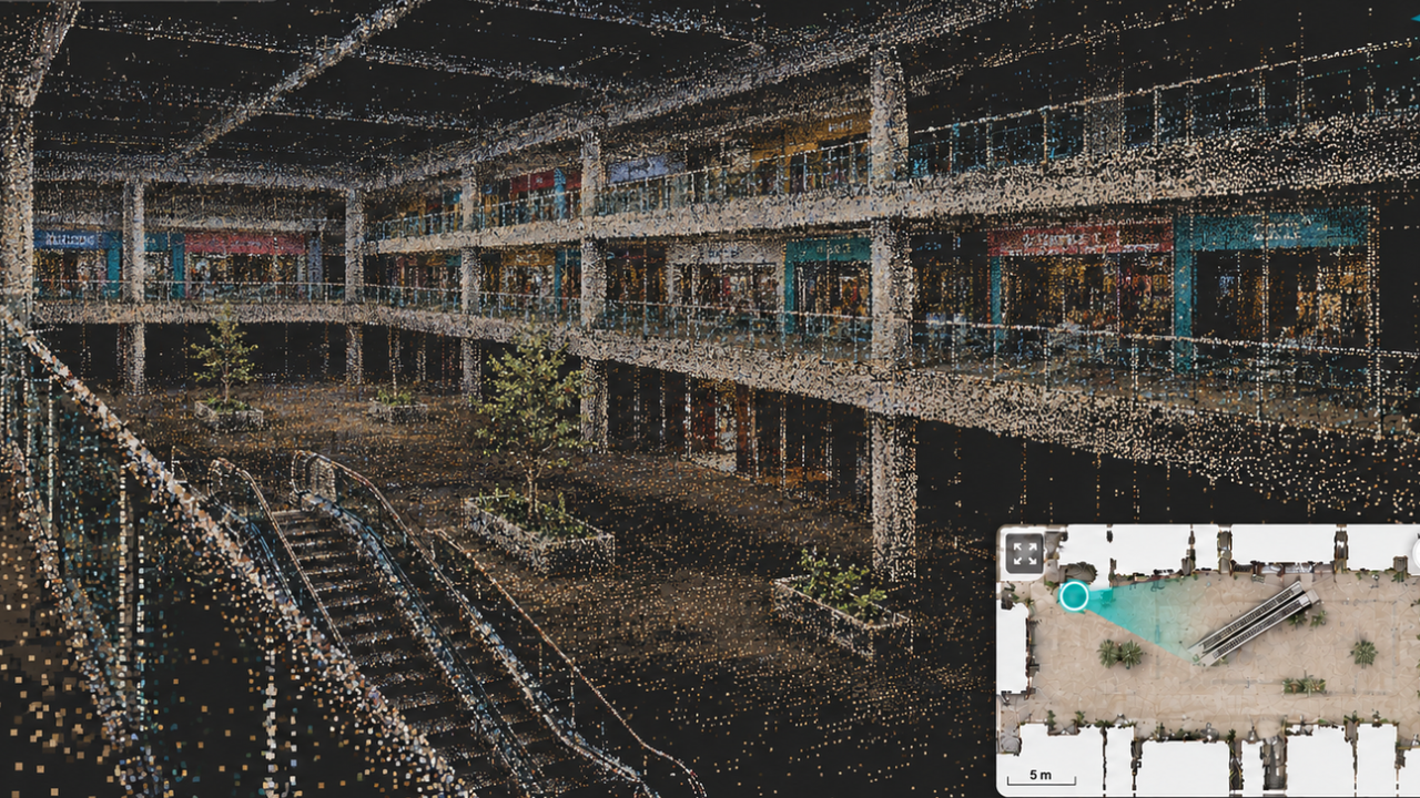
Compared with manual surveys and outdated drawings, combining LiDAR, SLAM and panoramic capture in one device changes how indoor spatial data is produced and used:
- Faster fieldwork. SLAM covers long corridors at walking pace and station scans take under 90 seconds each, so floors are captured far faster than with tape-and-drawing surveys, with less disruption to occupied buildings.
- Measured, not estimated. Centimetre-level point clouds replace hand measurements, reducing errors in floor plans, room areas and route lengths.
- Complete coverage. Every corridor, stair, lift lobby and back-of-house space is recorded, including areas missing from existing drawings.
- Visual and geometric data together. Panoramas let stakeholders review spaces remotely and confirm each point of interest, cutting repeat site visits.
- One dataset, many uses. The same capture feeds floor plans, BIM models, GIS layers, digital twins and navigation development, so owners pay for data collection once.
- Easier updates. When tenants change or spaces are refitted, only the affected areas need rescanning and merging, keeping navigation maps current.
- Safer, more accessible buildings. Accurate geometry supports step-free routes, emergency exit planning and clearer guidance for first-time visitors.
The real impact is on the people using the building: visitors find their way with less frustration, students and staff lose less time, residents and service teams reach the right place first time, and facility managers make decisions from a record that matches reality.
- Site assessment. Review existing drawings, agree access and plan scan stations and SLAM routes floor by floor.
- Mode selection. Station scans for detailed spaces; SLAM for corridors, walkways and links between floors.
- Capture. LiDAR, SLAM and 16K panoramas collected with overlap and closed walking loops.
- Point cloud generation. Laser data combined into registered point clouds per floor and building.
- Processing and quality checks. Dataset merging, cross-floor alignment, noise removal and dimensional checks.
- Export. Point clouds, .obj models and panoramas in the formats each client’s tools need.
- Deliverables. Data prepared for point cloud to BIM, floor plans, GIS layers or navigation app development.
Navigation-ready deliverables
- Registered point clouds of every captured floor
- 16K panoramic images a
- nd virtual tours for remote review
- Indoor floor plans for wayfinding design
- BIM-ready spatial data and as-built BIM models
- Navigation-ready geometry: corridors, entrances, vertical connections and points of interest
Clove Technologies has delivered BIM, geospatial and technology services since 2004. Our 4DKanKan META work connects to the rest of our capabilities: 3D laser scanning, LiDAR mapping, Scan-to-BIM, BIM coordination, GIS and digital twin solutions. One partner can take a building from field capture to BIM, GIS and digital twin deliverables.
Indoor navigation in malls, campuses and residences is only as reliable as the indoor map beneath it. By pairing 4DKanKan reality capture technology with Clove’s processing, BIM and GIS expertise, we turn complex interiors into navigation-ready spatial data that owners and navigation developers can build on.
Planning indoor mapping for a mall, campus or residential development? Talk to Clove Technologies.
What is indoor navigation? Indoor navigation guides people through buildings such as malls, campuses and residential complexes using a digital indoor map, an indoor positioning method and routing software.
Why do shopping malls need indoor mapping? Malls are multi-level, change tenants often and have many entrances. An accurate indoor map supports store-finder apps, parking guidance and facility management.
How does indoor mapping help university campuses? It gives a consistent, coordinated record of rooms, halls and walkways across many buildings, supporting room-finder apps, accessible routes and emergency planning.
How is 4DKanKan META used for indoor reality capture? It combines stationary laser scanning, SLAM walking capture and 16K panoramas. Its manufacturer lists point cloud accuracy of 1σ ≤ 1 cm at 20 m and projects of up to 99 floors.
Does 4DKanKan META provide a complete indoor navigation system? No. It captures the spatial data that indoor maps are built from. Live navigation also needs positioning infrastructure, routing software and an app or kiosk.
How does indoor spatial data support BIM and digital twins? Registered point clouds feed Scan-to-BIM models, which can then be linked with asset and operational data to form a digital twin for facility management.
Discover more of our innovative blogs
CAD Drafting vs BIM Modeling: How to Improve AECO Project Delivery
Reduce Project Timelines by 40% with our Advanced Scan to CAD Services

BIM-MEP Coordination: Reducing Clashes Before Construction Begins

Digital Twin vs BIM: How They Work Together in AEC and Building Operations
Let's Talk
Let’s discuss your requirements and see how our expertise can help on your next project.